Seismic Interpretation (2D, 3D & 4D)
Turn seismic data into a clear picture of structures, horizons, and how the reservoir changes over time.
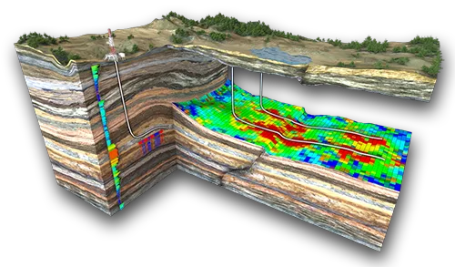
2D Seismic Interpretation
Map regional structures and horizons along seismic lines.
3D Seismic Interpretation
Build detailed structural and stratigraphic frameworks from 3D volumes.
4D Seismic Interpretation
Track reservoir changes over time with repeated surveys.
Decision Support
Define prospects and guide well placement.
Core Features
Data Integration
Seismic, well, and geological data combined into a single coherent framework.
Well Seismic Calibration
Well-to-seismic ties using logs, checkshots, VSP and markers to anchor horizons in time and depth.
Structural Interpretation
Fault and horizon mapping that defines the structural framework of prospects and reservoirs.
Stratigraphic Interpretation
Stratigraphic frameworks built from 3D volumes to delineate reservoir units and their extent.
Attributes Analysis
Seismic attribute analysis and attribute volumes that support reservoir delineation and prospect definition.
Velocity Model & Time-Depth Conversion
Velocity models calibrated to well data to convert interpreted horizons and faults from time to depth.
Foundation Package
Data Inventory & QC
Review, organize, and quality-check all seismic and well data.
Seismic Interpretation (2D, 3D & 4D)
Interpretation of seismic data to identify key horizons, faults, and structural features.
Maps & Sections
Key structural, facies, and property maps and cross-sections.
Report & Knowledge Transfer
Technical report documenting methodology, assumptions, results and uncertainties, reviewed with your team. How we work →
FAQ
Frequently asked questions
Clear and concise answers to the most common questions about our seismic interpretation services, including 2D, 3D, and 4D workflows.
Ask our teamWe provide end-to-end seismic interpretation services including 2D, 3D, and 4D seismic interpretation. Our scope covers structural and stratigraphic interpretation, fault and horizon mapping, seismic attributes analysis, time-lapse (4D) interpretation, and integration with well and geological data.
Typical inputs include seismic datasets (2D/3D/4D), well data (logs, checkshots, VSP, markers), velocity models, and any existing interpretations. We also perform data inventory, conditioning, and quality control (QC) as part of the project initiation.
Our interpretations support prospect generation, reservoir delineation, well placement, and field development planning, reducing subsurface uncertainty and risk.
Yes. We perform 4D seismic interpretation to monitor reservoir changes, fluid movement, and pressure evolution, supporting reservoir management and EOR strategies.
Deliverables include interpreted seismic sections, fault and horizon maps, attribute volumes, prospect maps, and a comprehensive technical report compatible with industry-standard software.
22+ seismic interpretation projects (2D, 3D, time-lapse)
Fault & horizon interpretation on datasets up to 5,000+ km²Support for exploration screening, reservoir monitoring, and field redevelopment